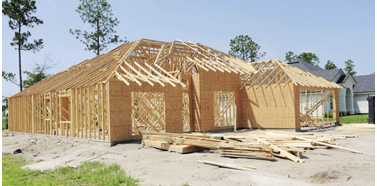
Before the walls go up, we craft a digital twin of your home a fully immersive, virtual blueprint of every beam,
pipe, and wire. Using advanced scanning and point cloud technology, we capture your home in incredible detail
—right down to hidden systems. Once scanned, you can interact with a web-based, panoramic viewer that lets
you explore every corner of your home before any drywall is installed. This digital twin not only protects you
by documenting everything, but it also gives you a dynamic tool for future renovations, insurance peace of
mind, and a clear picture of what’s inside. We guide you step-by-step from on-site scanning to web viewing so you
can see, understand, and safeguard your home like never before.”
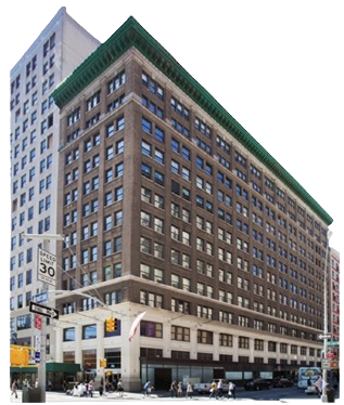
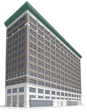
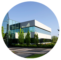
Precision as-Built Plans and 3D Models for Renovations and Filings
We specialize in creating exact as-built plans using cutting-edge CAD and Revit 3D models. Whether you’re
planning a renovation, preparing for a permit filing, or simply need a clear, updated layout, we deliver precise,
detailed plans. Our services include interactive 3D Revit models, immersive virtual walkthroughs, and accurate
CAD drawings that let you explore every detail of your building. We turn your vision into a precise digital
reality, ensuring every renovation step is backed by data you can trust.
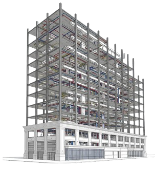
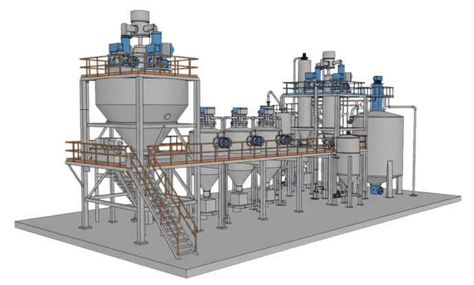
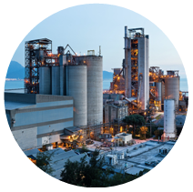
Advanced Industrial Modeling for Precision Plant Systems
and MEP Coordination"
We specialize in creating precision as-built plans and 3D models using CAD and Revit. We provide
advanced modeling for industrial plants and MEP systems, capturing every piece of equipment, piping,
and structural detail. Using laser scanning paired with Revit, we produce exact digital twins that
serve as a foundation for thorough analysis, efficient design coordination, and precise project
management. Whether it’s a cement factory or a complex industrial facility, we ensure every system is
mapped with unmatched accuracy, providing a reliable digital record for all future planning and
modifications.”
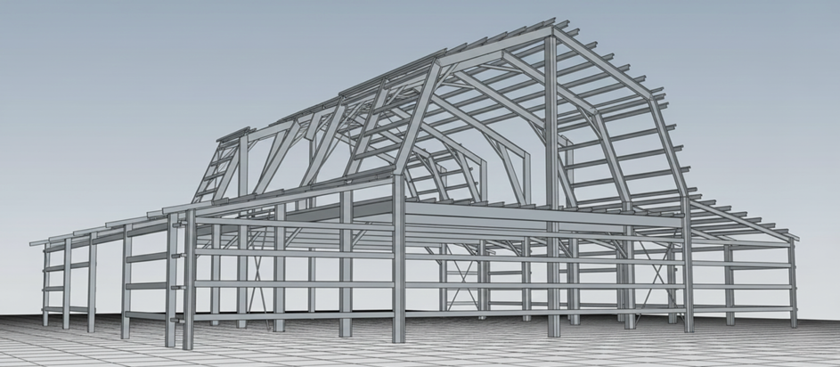
steel and Concrete Framing Modeling for Complex
Structures
We conduct full-scale steel and concrete framing modeling, capturing every intricate element of your
structure. Using state-of-the-art laser scanning and Revit modeling, we create hyper-detailed digital
twins of complex industrial structures. Every steel beam, concrete column, and load-bearing frame is
modeled with exact specifications, dimensions, and material details. We go beyond the surface
documenting connections, anchoring points, and support structures ensuring your team has a
complete, accurate model for fabrication, coordination, and safety assessments. These detailed plans
empower your teams to visualize the entire system, optimize structural efficiency, and ensure every
load path is perfectly understood before construction begins
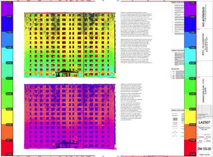
Wall and Floor Flatness Inspections with ATS-Standard Heat Map Reports
we provides highly accurate wall verticality inspections and Floor Flatness and Levelness (FFL)
reports for concrete slabs. Using stringent ATS standards, we deliver a precise heat map of your
slab’s flatness and verticality, identifying even minor deviations. Our deliverables include a
comprehensive, color-coded visual report, exact measurements down to millimeters, and a clear, data
driven assessment. These precise, actionable insights ensure your team can correct any irregularities
early, optimizing safety, quality, and compliance before your next phase of construction.
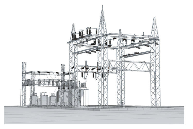
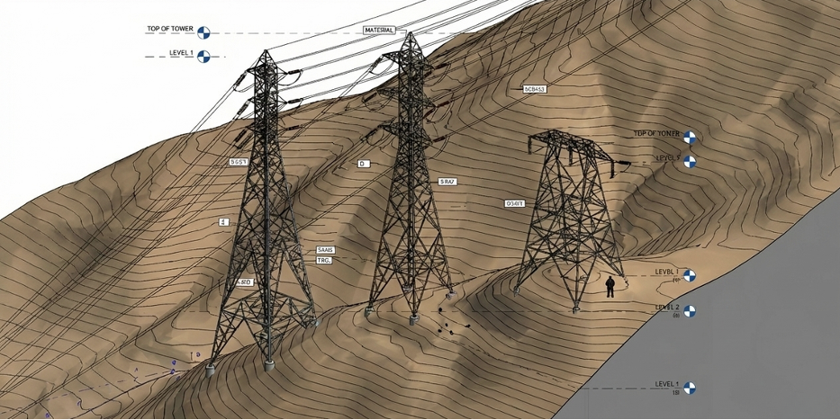
Digital Twins for Electrical Transformer
Plants: Enhanced Safety
We provide detailed scanning and digital twins of electrical transformer facilities. By capturing every wire,
conduit, and transformer with high-precision laser scanning, we create an accurate, immersive digital twin of
your entire plant. This service ensures you have a precise record of the layout, making future upgrades and
maintenance faster and safer. With this virtual model, you can easily trace circuits, verify load paths, and plan
new installations all before any disruptions occur ensuring safety, efficiency, and total clarity at every step.”
High-Precision Topographic Maps for Large-Scale
Projects Using Drone and Advanced Surveying
Technology
We provide comprehensive topographic surveys for large-scale sites using advanced drone and surveying
technologies. Our detailed topographic maps capture every elevation, contour, and feature across expansive
areas, providing a precise foundation for planning, construction, and infrastructure development. With every
scan, we deliver a fully accurate, high-resolution model, allowing you to make informed decisions and ensure
your project is built on a solid, data-driven foundation
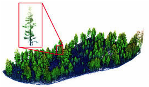
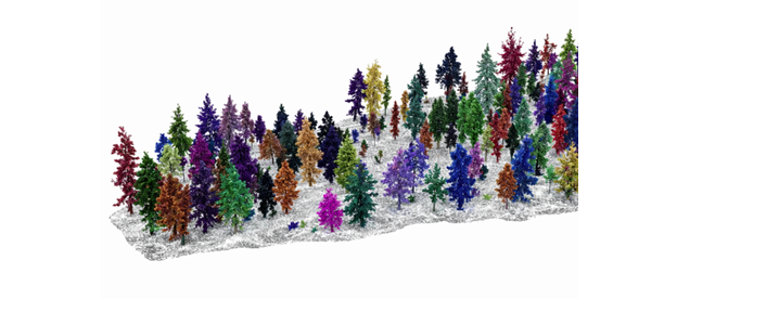
Tree Surveys Mapping Canopy
we conduct comprehensive tree surveys, meticulously documenting each tree’s canopy, height, and diameter.
Using advanced 3D mapping, we pinpoint every tree’s exact location, ensuring a precise GIS map. This allows us
to provide detailed insights into the distribution of species, canopy coverage, and tree health across your
sitegiving you a complete, data-rich picture for planning, conservation, or development.”
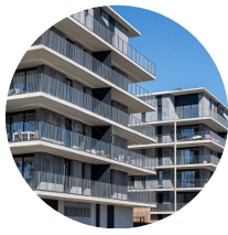
Full Spectrum of Service Coverage
Our coordination services span all property types, from site development to complex commercial projects. Our
network and expertise allow us to handle a wide range of projects.”